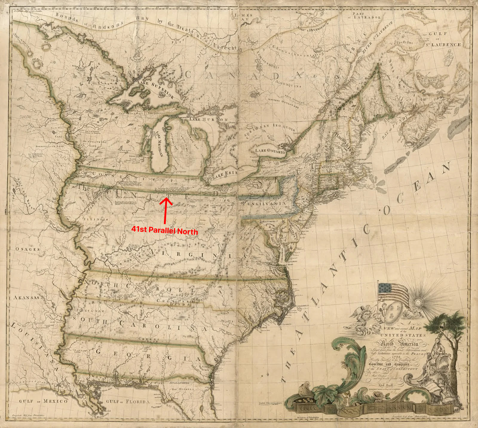
The 41st Parallel: A Line of History and Legacy
If you stand at the southernmost point of Connecticut, where the land meets the Long Island Sound, and gaze westward, you are staring down a line that determined the course of Main Street in Plymouth, Ohio. This is no ordinary line; it is the 41st parallel, a straight path that not only marks a geographical boundary but also tells a story of ambition, legacy, and resilience. It is the same arrow-straight line you see on the map dividing Nebraska and Wyoming from Utah and Colorado.
The origins of this line trace back to 1662, when Charles II, the King of England, signed a charter granting the Colony of Connecticut lands stretching westward along the 41st parallel, from the Atlantic Ocean to the Pacific. Over the years, as the young United States began its westward expansion, Congress encouraged Connecticut to cede most of its western lands. However, the resourceful residents clung to a significant parcel: the Connecticut Western Reserve in northeastern Ohio. This region, originally part of that land grant, became a vital settlement destination for people from Connecticut and other states, with the 41st parallel marking its southern boundary.
 When the original colonies in America were granted their territories by the King of England, each boundary ran due west all the way to the west coast.The southern boundary of the land granted to Connecticut followed the 41st Parallel
The 41st parallel north defines several state boundaries in the United States, including:
- Wyoming: The southernmost border of Wyoming, which borders Utah and Colorado.
- Nebraska and Colorado: Part of the border between these two states.
- New Jersey and New York: The northeastern border between these two states, which begins at the point where the 41st parallel crosses the Hudson River.
It also stretches across the southern boundary of the Connecticut Western Reserve and the Congress Lands north and east of the First Principal Meridian, both in the State of Ohio.